Do I need a land survey to obtain a cadastral passport. How to register land without land surveying
Even if there is a cadastral passport of a land plot, then the question of whether land surveying is necessary or not should be decided individually. Situations may arise when the plaintiff will be the owner of a nearby plot of land, who has reasonable circumstances to turn the case against the defendant who owns the cadastral passport, and one of the reasons for such a decision by the judicial authorities will be the absence of an officially conducted land surveying procedure. Thus, no landowner is immune from undesirable legal consequences in the future, provided that he does not have an approved land survey plan for the land he owns.

As a rule, these consequences arise in connection with various claims of third parties interested in expanding their land boundaries persons who prepare for such court cases thoroughly, hiring expensive lawyers and collecting the maximum possible amount of necessary documentation. In order not to have to defend against such attacks, it is possible to draw up all the official papers in advance in the proper order, among which there will be an appropriately drawn up act of land surveying. In this case, the plaintiff, when applying to the court, will have nothing to support his arguments and the case will fall apart.
Grounds for land surveying
A cadastral passport is a document that provides information that is both legal and organizational. It allows us to conclude that there is a confirmation of the cadastral registration of a specific allotment of land, that is, its registration established by law. The specified accounting consists in assigning a certain serial number, as well as binding to a physical or legal entity who owns this allotment as property. The document in question also contains the following information:
- time of creation of the account;
- land category, purpose and type of site;
- complete information about the object (address data, area, urban district, regional center);
- marking and demarcating lines;
- exact coordinates;
- size information (area);
- contract or agreement on the basis of which land plot was acquired in ownership;
- legal encumbrances, restrictions on use, easements (all if any).
Various changes in land legislation occur regularly, they mainly concern land registration and registration. Enough big number owners earlier, while refusing to carry out surveying of their allotments. Why such a situation was widespread is not clear, but most likely, this is due to the usual reluctance to do what was not required by law. This order of things led to a large number of errors in defining boundaries. land plots... Moreover, the earth tends to lose its original shape and, over time, undergo such changes that require clarification. First of all, this applies to land plots where the soil is subject to rapid erosion. A large number of cadastral passports do not contain information about what borders the specified territory has, this is also one of the reasons why land surveying is needed.
Since 2018, the compulsory land survey will become the norm. Without it, it will be impossible to carry out any legal action as it is today. In other words, the question will no longer arise if there is a cadastral passport for a land plot - whether it is necessary to do a land survey or not. Thus, we can say that the land survey gives legal force to the cadastral passport, and also provides weighty guarantees to the owner of the land plot, even in the event of any claims from interested parties.
Procedure and terms of the procedure
For accurate land surveying, the intervention of a qualified specialist is required. Basically, the owners of summer cottages connect them to this process so that there are no problems in the future, and it also becomes possible to implement the planned construction. The essence of the implementation of this procedure through an intermediary lies in the existing need to accelerate it. Otherwise, when there is no reason to quickly register the land that is owned, then you can generally fill out an application at the local administrative body, which is engaged in the production of these works at the expense of the regional budget. Land surveying will also be free if it is required by a large family registered with a special account.
To carry out the above procedure, you will need:
- take into account the entire previous history of the transition and registration of ownership of the land plot subject to land surveying. This may include information such as baseline coordinates, previous measurements, or the grounds for owning nearby allotments;
- drawing up a special project of the established form. Where the current geographic coordinates are entered, as well as all the detailed characteristics of the terrain on which the specified work is carried out;
- proper execution of the land delimitation act, where all information about both the owner and the written consent of the persons who own the neighboring allotment must be present. This document is drawn up by an employee of an organization licensed to provide such services or by a representative of the local (city, district) administration;
- calculation and accurate calculation of the area, as well as topographic survey territory and production of a detailed site plan.
Conducting a boundary case involves sequential stitching of all sheets, where the above act is listed first. This is followed by any claims arising in the course of establishing the boundaries of the land area. As a rule, after the final preparation of the land survey, it is necessary to register the cadastral passport. Now these documents will be required for legal transactions with a land plot of any category and purpose (gardening, SNT, horticulture, individual housing construction, etc.). If it is necessary to obtain a survey file, the applicant must indicate in what form it is required, since its issuance can be carried out both in electronic and in a written copy.
Whether it is necessary to prepare a project now, whether it is necessary to do land surveying in the event that there are no disputes with neighbors, and the owner himself has drawn the line between the lines and does not plan to sell the plot in the near future, the citizen himself should decide, since only he makes the decision. It does not matter whether the horticultural or agricultural allotment is subject to land surveying, the main thing is that the information in the cadastral passport coincides with the information in the land survey file. In this case, the owner will be legally protected from many issues and problematic situations that arise today.
The possession of land plots of various categories presupposes a conditional part in the law common use... When a citizen expresses a desire to allocate a certain land plot into an individual (independent) object, then he can do this only in the way that was discussed above. Also, there are no other ways to “split” common ownership into different shares. Or, on the contrary, if two independent owners come to a decision on the need to combine two or more plots of land, then it will also be necessary to carry out a procedure related to land surveying, since its configuration will be subject to change and should be on the new list.
Important! So, a citizen who is obliged to carry out land surveying, when it is planned to transfer ownership or any other legal action, provides himself with a certain peace of mind in the future, as well as protection from the loss of a part of the land allotment.
It should always be remembered that the land survey (being on the cadastral register) is documentation of a technical and legal nature, which allows you to reasonably prove the existence of a legal right of ownership, as well as reflect any unauthorized attacks on a land plot. Thus, you need to contact a serious and reliable organization that has extensive experience in providing services in this area, as well as all the necessary permits, including the appropriate license, for carrying out land surveying. Before concluding an agreement with a specified organization, it is imperative that a close study of all its conditions is required, where special attention is paid to the timing of all these services and the procedure for financial settlements between the parties.
Quite an expensive undertaking. Therefore, the question often arises about the possibility of carrying out various operations with a memory device that did not pass the land survey.
The issues of the need for land surveying are considered in laws No. 122-FZ of 21.07.97, No. 93-FZ of 30.06.2006 (On dacha amnesty), No. 221-FZ of 24.07.2007 "On the State Cadastre".
 Some provisions of the articles of the laws were clarified by Law No. 447-FZ of December 21, 2014. In particular, according to it, from January 1, 2018, legal entities that have imprecise boundaries will not be registered.
The same law addresses the issues of carrying out activities for complex cadastral works, which include land surveying.
The need for land surveying in the presence of a cadastral passport
The need for land surveying is indicated in Articles 19 and 20 of Law No. 122-FZ. It says that in the case when such a memory does not have data on the coordinates of its boundaries, state registration The memory device may be suspended or denied.
However, there are also given exceptions to this rule... These include the following cases: 
- the site is given for, truck farming, as well as for the construction of a garage or individual housing construction;
- the site was registered earlier in accordance with the established procedure and the owner has title documents;
- the right to the ownership of the share of the memory is registered;
- the right to a memory card arises upon renewal of c.
The above exceptions will cease to apply from 01.01.2018 (Law No. 447-FZ).
 That is, from the beginning of 2018, registration or re-registration of all storage devices will have to be carried out taking into account the presence of land surveying.
In addition, any transactions (for example, a pledge,) with a memory device that have a cadastral passport and number, but who have not come, will not be able to carry out land surveying.
In general, the need for land surveying for a memory device that has, depends on two reasons: 
- transactions that the owner is going to make with the memory;
- the time of these transactions (until 31.12.2017 or later).
If the owner is not going to make any transactions with his memory, then it is not necessary to carry out its surveying. Moreover, the land surveying process is quite costly. If the owner is going to make any transactions with the memory (, donation,) after the onset of 2018, then he will have to carry out land surveying of the memory.
When conducting transactions in 2017, land surveying is not mandatory, but in this case, it must be borne in mind that the transaction participant (for example, the buyer), if desired, in the future, to make a transaction with the purchased land plot will still be forced to conduct a land survey.
In some cases, when selling a plot in 2017, it is also desirable to carry out a land survey. This may be required in the following circumstances: 
- if the actual area of the storage unit turns out to be less than the declared area, then this fact must be legalized in order not to pay an extra tax on land;
- if the actual area of the storage device has exceeded the area declared in the documents, then this fact must be legalized by land surveying;
- to clarify the boundaries of the sold site and prevent;
- when selling.
In other cases, when the owner of the storage device, who has a cadastral passport, has no intentions to make any transactions with the storage device and there are no disputes with neighbors along the borders of the storage device, land surveying may not be carried out.
The need for land surveying in servitude
There are two options for setting on the memory:
- the easement is established for the entire plot.
- the easement is established on a part of the plot.
According to Art. 27 of Law No. 122-FZ, when establishing an easement for the entire storage unit, provide a cadastral passport for it, and, therefore, it is not required to carry out land surveying.
In case of servitude for part of the storage facility, it will require a cadastral passport of the storage facility, which indicates the scope of the easement. Or an extract from the cadastral passport, which contains information about the part of the storage device to which the servitude applies. That is, in this case, cadastral work will be required, with the help of which the site on which the easement is installed should be formed.
It is possible to draw up one plan of the boundaries of the memory, which will show the boundaries of both sections. It should also contain a table that indicates the geodetic data of the boundaries, including the angles and lengths of the sides of the parcels.
Land surveying in SNT
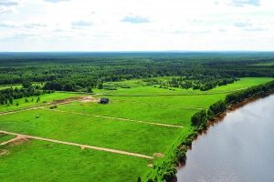
Land surveying as a mandatory item
Without it, it is impossible to register land and obtain a cadastral passport. It is not enough to put up a fence and protect your site, you need to legally confirm its boundaries. This procedure is handled by specialized non-governmental companies. It is very difficult to carry out land surveying on your own.
The organization, which will conduct, must provide all documents to the site. After the contract is concluded, specialists will begin to carry out work:
- They will discuss all the details with the neighbors, whether there are any questions about the boundaries of the site, collect all the necessary information, measure the site, conduct a topographic survey.
- After all these actions, there is a period of information processing. After a while, the customer receives a land-line plan.
- You need to contact a company that has the appropriate license, otherwise the landline plan will be invalidated.
- The best way to pay is from. You give part of the money at the conclusion of the contract, and the rest - after receiving the land survey plan. If payment is made through Sberbank, save the receipt and give a copy to the organization itself. The contract is concluded without fail.
Payment depends on the area of the site and the amount of work. Within 10 days after the conclusion of the contract and the advance payment, surveyors must arrive at the site and take surveys and measurements. The area of the plot must match the size indicated in the certificate of ownership.
If the site does not have a fence, specialists will leave marks at the borders. Land surveying must be repeated every time the size of the plot changes or if the owner decides to sell only part of it.
The land-surveying procedure will protect the boundaries of the site from the encroachments of third parties. But in the very process of land surveying, neighbors can show it if it seems to them that you have illegally increased the boundaries of your land plot. These issues need to be settled in advance.
Possible difficulties in obtaining a cadastral passport

Land plot as property
In the process of registering or obtaining a cadastral passport, unforeseen difficulties may arise. Consider the most common problems that you may encounter when registering a cadastral passport for a land plot:
- The area indicated in the documents and the real area during land surveying does not match. It often happens that in reality the site is larger in area than it should be according to the documents. In this case, you should pay attention to how much the real area exceeds the indicated one. Each region has a minimum allowable area for farming. If the difference in areas does not exceed this permissible minimum, then you can register a plot with a large size. However, the agreement of the neighbors and the administration is important here.
- The Cadastral Chamber refused to register the site. Not every land can be registered as its own. If it turns out that these lands have scientific or cultural value, and are also related to military exercises, you will be denied registering the site.
- Instead of a document with a cadastral number, a notification will be sent, where the reason for the refusal will be spelled out in detail.
- The Cadastral Chamber refused to issue a cadastral passport due to the absence of this site in the cadastre, but the owner is sure that he registered the site. This can happen if the package of documents was lost or was not transferred further by the authorized bodies. In this case, you need to present all the documents that have survived after the land was registered.
The most common reason for difficulties in obtaining a cadastral passport usually lies in the carelessness of the applicant or registrar. For example, if there are not enough documents or there are errors in them. An error, inconsistency, or other documents may be missing in the boundary plan. Within a certain period, errors must be corrected and after a while will be received.
Cadastral passport of the site: what is it for? Answers - in a video consultation:
Have you noticed a mistake? Highlight it and press Ctrl + Enter to let us know.
Land surveying is a procedure for determining the exact boundaries of a land plot directly on the ground using geodetic surveys. It costs a certain amount of money, since all the work is done by specialists who are called cadastral engineers. It is clear that no one wants to pay extra, so a completely legitimate question arises - how to register land without land surveying and whether this can be done in principle.
Why do I need land surveying
November 23, 2007 was adopted the federal law for No. 268-FZ "Amendments to certain legislative acts Russian Federation on the issue of formalizing in a simplified manner the rights of heirs, as well as other citizens to land plots ”, which abolished the obligatory land surveying when registering the ownership of some land plots. And, nevertheless, the land surveying procedure in certain cases remains extremely important. Imagine that you are purchasing a land plot, having only an approximately delineated plan of its boundaries. If you yourself incorrectly determine its boundaries on the ground, this may threaten you in the future with significant troubles, the least of which may be constant conflicts with the owners of neighboring plots. In addition, land surveying has many obvious advantages. So, after surveying your site, you can slightly expand its boundaries, based on those that are in fact, and not on paper, and therefore increase the area of your land plot. You just need to remember that land surveying involves the obligatory coordination of borders with neighbors so that your expansion does not affect their interests. The second obvious plus, if you are the owner of an abandoned land plot for which you simply do not have enough time, surveying and accurately defining its boundaries will serve as a kind of protective letter, if suddenly one of the neighbors wants to expand their own plot, taking advantage of your absence. Surveying is extremely useful even in that case. If your site has no neighbors, being, in fact, isolated. And its boundaries are very, very vague. Land surveying allows you to prevent disagreements if you need to divide one large plot into several small ones, for example, if you are one of several heirs and want to allocate your share of the inheritance in the area.
You cannot do without land surveying if your land plot is located in a place where the price of land is extremely high, so that between the owners of neighboring plots there is a struggle literally for every meter of the available territory. In general, as you can see, in many cases it is better to spend a certain amount and conduct a land survey, so that later you can just sleep peacefully.
When can you do without land surveying?
In accordance with the above law, the design of summer cottages and horticultural plots can be carried out without land surveying. If, of course, you know exactly the boundaries of your site, they are indicated by a fence or other fence, while you do not have any conflicts with the owners of neighboring sites about how exactly this fence is installed. In order to register the ownership of such a land plot, you just need to have a gardener's membership book, and when registering, give only a description of your plot compiled in free form.
If you have a certificate of ownership of a land plot of the old model, then in order to issue a new one you do not need to carry out the procedure for land surveying. Just in the cadastral passport, which will be given to you in the regional Cadastral Chamber, it will be indicated. That the boundaries of your site are not defined with sufficient accuracy. Nevertheless, it will be assigned a cadastral number, you can get an extract from the cadastral passport, this will be enough to register your right to a land plot.
Finally, the third case, when there is absolutely no need to carry out land surveying, is if you decide to formalize the ownership not of the land plot itself, but of that building or country house that is on it. For this purpose, again, you will need a cadastral passport of the site, to which its plan on a scale of 1: 500 will be attached. And for registration of the building, you will receive a technical passport from the BTI. That's all you need to do.
How to arrange land without land surveying.
- Check what documents of title confirming your ownership of the land plot you have on hand. This can be a decree of the local administration on the transfer of a land plot into your ownership or inherited possession for life, a certificate of inheritance, or any other similar document. Either the deed of ownership is pink or blue.
- In order to obtain a cadastral passport for a land plot, you will need to contact the regional office of the Cadastral Chamber, present there the documents that you have and pay a state duty of the established size, they will additionally ask for technical plans of those buildings that are on the site or a certificate from the BTI, that such structures are absent. They will tell you when you need to come up for the finished document. The usual time for preparing a cadastral passport is 10 days.
- With a cadastral passport, a plan of the land plot and the title documents you have, you will need to go to regional office Rosreestr - Registration Chamber - present a passport, pay a state fee and write there an application in the prescribed form. The usual term for registering ownership of a land plot is 1 month from the date of application.
